
McHenry Neighbors Across Record Layers
The best block lookup combines sources without flattening their meanings. County GIS defines nearby parcels. The tax inquiry supplies the current assessment record, while Recorder instruments explain deed, easement, plat, or lien links. City maps place the address inside municipal wards, zoning, landmarks, and development areas. Historic directories and maps show dated people and places. Voter tools have narrow use rules and cannot be browsed as an open block roster.
| Source | What It Shows About a Block | Access |
|---|---|---|
| County Athena | Adjacent parcels, geometry, address labels, owner and sale context, and buffer relationships | Open map tools; date-stamp results |
| wEdge tax inquiry | PIN, site and mailing fields, township, tax class, and parcel record | Free address search |
| City and PlanDev maps | Wards, zoning, landmarks, development, subdivision, water, and land-use layers | Open viewers; check map date and legend |
| Recorder AVA | Deeds, easements, plats, and legal documents for nearby parcels | Free index; copies and images are separate |
| Historic directories and maps | Dated occupants, businesses, owners, roads, lots, and footprints | Libraries, MCHS, and Library of Congress |
| Civic or association sources | Verified organization names and public contact routes | No consolidated official registry was found |
An owner name may belong to a trust, estate, company, or person who receives mail elsewhere. A matching site and mailing address may support owner occupancy, but it still does not list every person at the home. For McHenry neighbors, report the role exactly as the custodian labels it and avoid guessing about the household.
Map a McHenry Block Outward
The McHenry County Athena viewer is the spatial starting point. Its tools include Property Info, Buffer, Tri-View, and Export CSV. A buffer measures a chosen distance around a feature; it does not create a verified list of residents. Use it to select the parcel group, then inspect each official record on its own terms.
- Locate the anchor address in Athena and confirm its parcel boundary and PIN.
- Set a small, stated radius or click the lots that touch the anchor parcel.
- Open each selected parcel in the tax inquiry and preserve the site, mailing, class, township, and tax-year labels.
- Use the Recorder only when a deed, plat, easement, or legal-description question matters.
A block is a bounded spatial question. A full named road needs the broader workflow in the McHenry street directory. Keep the radius, map date, source agency, and meaning of each field visible so nearby ownership is not presented as present residence.
Read McHenry Neighbor Map Layers
The county PlanDev viewer separates zoning, existing land use, the 2050 land-use plan, subdivisions, proposed subdivisions, flood and wetland areas, watersheds, topography, and historic imagery. The McHenry map center links city wards, zoning, landmarks, TIF areas, transportation, and development stories. Each layer answers a different question.
- Parcel
- A mapped unit used for land and assessment records.
- Subdivision
- A recorded land division. Its label does not prove an active association.
- Ward
- A political district used for city representation, not a neighborhood roster.
- Zoning
- A land-use rule for a site, not proof of ownership or occupancy.
McHenry postal labels can also cross government lines. A ZIP code does not prove a city limit, ward, township, tax district, or current home. Confirm the parcel in county GIS and municipal status in the city map before drawing a boundary around your neighbors.
Historic McHenry Neighbor Names
City history names Gagetown or West McHenry and Centerville or Riverside. Older newspapers, maps, and directories may use those terms where a modern search expects a street, subdivision, or municipal label. The Fox River and rail corridor also act as stable geographic anchors. These terms are useful search synonyms, but their historical extent must be checked against the dated source.
Riverside history includes the Riverside Hotel, built in 1864, and later river recreation, lotus-bed, and boat-building references. Those facts can guide a search in maps, photos, and Plaindealer issues. They do not show that a current parcel or neighbor continues the same use. A historic area is context, not a civic association and not a present resident group.
Note: Label every historic-area result with its map, directory, or newspaper year so old geography is not mistaken for a current boundary.
Compare McHenry Blocks Over Time
PlanDev's imagery years make a clear then-and-now sequence possible: 1939, 1967, and selected views from 2005 through 2026. Add the 1839 survey, 1862 landowner map, 1872, 1892, and 1908 atlases, Sanborn sheets, and later plats for a longer view. A directory can then add a dated person or business to the mapped block.
The McHenry County Historical Society property-research workflow shows how to link these layers through the PIN, legal description, Recorder document number, historical maps, and land records.
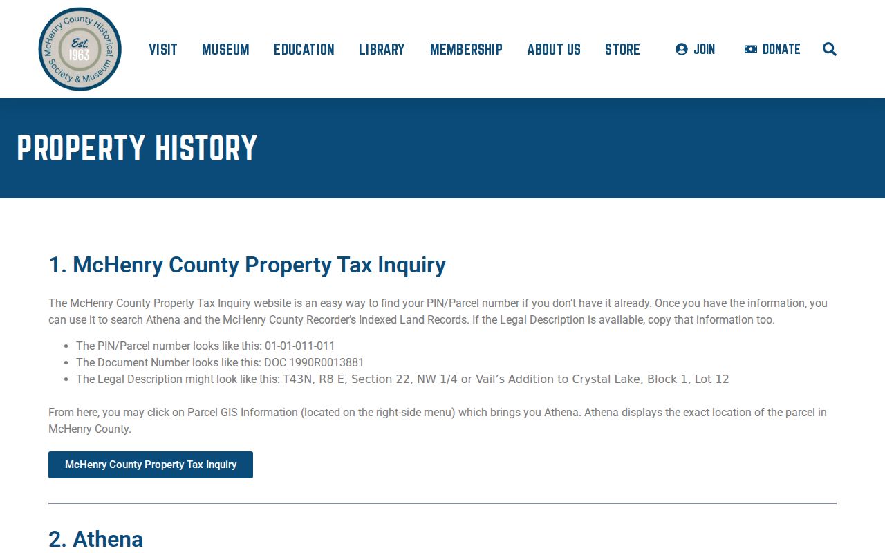
The workflow prevents a visual guess from becoming a claim about neighbors. Aerial imagery may show construction or land change, while deeds and dated directories establish record roles.
McHenry Neighbors and Civic Geography
Ward maps, agendas, election notices, and canvass reports describe civic geography rather than households. The Illinois voter registration lookup is an exact-match service. It requires a named person, birth date, ZIP, and then address information. It cannot browse a whole McHenry block. A full voter file is a separate controlled request, with sensitive fields withheld and use limited by the Illinois Election Code.
For a ward question, use the current city map and date. For voting status, use the Illinois SBE Registration Lookup. For canvass or precinct records, contact the McHenry County Clerk. Do not turn those sources into an implied list of your neighbors. They show a district, an election result, or a specific registration match.
Verify McHenry Community Groups
No consolidated official registry of McHenry neighborhood or homeowners associations was found. County map layers may show a subdivision, and city sources may name a historic area, but neither fact proves that a voluntary group exists or maintains a directory. Verify each organization through its own current contact or ask the city office responsible for the relevant records.
City Clerk
Ask about city records, agendas, and a narrowly described public-record request through the McHenry City Clerk.
Community Development
Confirm subdivision, zoning, permit, or planning labels through the city map center and Community Development records.
Historical Society
Use MCHS for historic organizations, community files, oral histories, maps, and local papers by appointment.
An association directory, when one exists, may be private or limited to members. Use its published contact route and respect its access rules. Do not infer a membership list from parcel geometry.
Library and historical-society collections are useful fallback channels when no current group directory exists. McHenry Public Library holds local organization material, newspapers, telephone directories, maps, and more than 2,000 local-history items. MCHS holds community files, organization papers, oral histories, and photos by appointment. Ask for a named subdivision, street segment, civic body, or date span. Staff may locate an unindexed folder, but a historic organization name still needs a current source before it is presented as active.
Official McHenry Neighbor Records
Official sources identify their custodian, update date, field meaning, and correction path. Commercial neighbor tools may blend stale directories and purchased data without showing when a record changed. They can also merge people with similar names. Use the category only as a lead and return to the agency record before relying on it.
| Source type | Useful strength | Main limit |
|---|---|---|
| County or city record | Named custodian and defined record role | Not a complete household list |
| Library or archive | Dated local directories, maps, and newspapers | Historical evidence may be incomplete |
| Commercial compilation | May suggest a spelling or older address | Source dates and corrections may be unclear |
Nearby McHenry Municipal Records
Permits, licenses, maps, ordinances, agendas, and minutes can add public context to a block. City permit records may be searchable by address, name, or parcel number, though the vendor interface could not be fully inspected during research. A separate open code-enforcement case index was not located. When online access fails, send a narrow request through the city transparency and FOIA route.
State the address, date span, and record series. Ask for electronic delivery and redaction where appropriate. City records and county records are held by different custodians, so a city request will not replace a Recorder or tax search. Illinois FOIA generally gives a public body five business days for a noncommercial request, subject to lawful extensions and exemptions.
Phone, mail, email, hand delivery, and an electronic request portal remain useful when a map or vendor search fails. A precise request costs less time than asking for every file on a block. Separate permit records from planning maps and meeting records, since each series may have a different keeper, date range, or exemption.
Protect Privacy of McHenry Neighbors
Public parcel and deed records do not expose every occupant. Driver-address information is restricted, and no public utility-customer or delivery list was found. Court, vital, and voter systems also withhold protected fields. The Illinois Address Confidentiality Program supplies eligible survivors with a substitute address for covered new public-record interactions. It cannot promise removal from every older record.
Show only what is needed: the source, date, parcel or district relationship, and exact public role. Do not reproduce birth dates, signatures, private contact details, or sensitive IDs. If a record seems wrong, use the custodian's correction process. Never try to work around a redaction, protected account, or access limit.
Lawful use. McHenry neighbor research is for civic context, reconnecting, and personal safety awareness. Illinois law prohibits stalking, threats, harassment, and intimidation.