
Walk a McHenry Street
A reliable McHenry street directory search separates ownership from occupancy. The county tax inquiry can return a parcel from a house-number range and street name. Athena then locates that parcel among its neighbors. The Recorder index supplies deeds and other instruments tied to the parcel or address. An individual voter-registration check can confirm only the named voter who completes the required form; it cannot browse a whole block. Older directories may supply dated household clues, but they describe one publication year, not the present.
- Normalize the house number, directional, street type, city, and ZIP, while saving the original spelling.
- Search the McHenry County Property Tax Inquiry by address range and record the returned PIN.
- Open Athena to confirm parcel shape, adjacent lots, and map labels.
- Carry the PIN or address into the Recorder's AVA index and follow deeds, plats, easements, and releases.
- For an older household, check dated telephone and criss-cross volumes at the local libraries.
This sequence creates a source trail: address to parcel, parcel to owner, owner to recorded instruments, and then dated household evidence. It also exposes mismatches. A tax mailing address may be elsewhere, a deed may be newer than the free index, and a historic street label may differ from today's postal form.
Search McHenry Tax Addresses
wEdge is the strongest first stop for a modern address. Its Address tab supports a range, which makes a by-street review possible without guessing an owner. The county advises against excess directional detail when that prevents a match. Start with the street root, then restore the full form. A result can expose the PIN, site and mailing addresses, township, property class, tax code, legal description, values, exemptions, and sales or payment history.
| Portal area | Fields available | Best use |
|---|---|---|
| Basic | Parcel Number/PIN or Owner Name | Confirm a known parcel or owner |
| Address | House Number Low/High, Street Name, City | Search a street segment |
| Sales | Sale Price Min/Max, Sale Date Min/Max | Compare returned sale records |
| Advanced | Property Classes, Townships, Tax Districts, Tax Years | Narrow countywide results |
The inspected portal described current taxpayer information and showed a sample parcel with tax-year choices from 2008 through 2026. That sample does not prove the earliest year for all parcels. Search access is free; the separate tax-payment path is not required to view a record.
The official tax inquiry screen shows how an address search is entered.
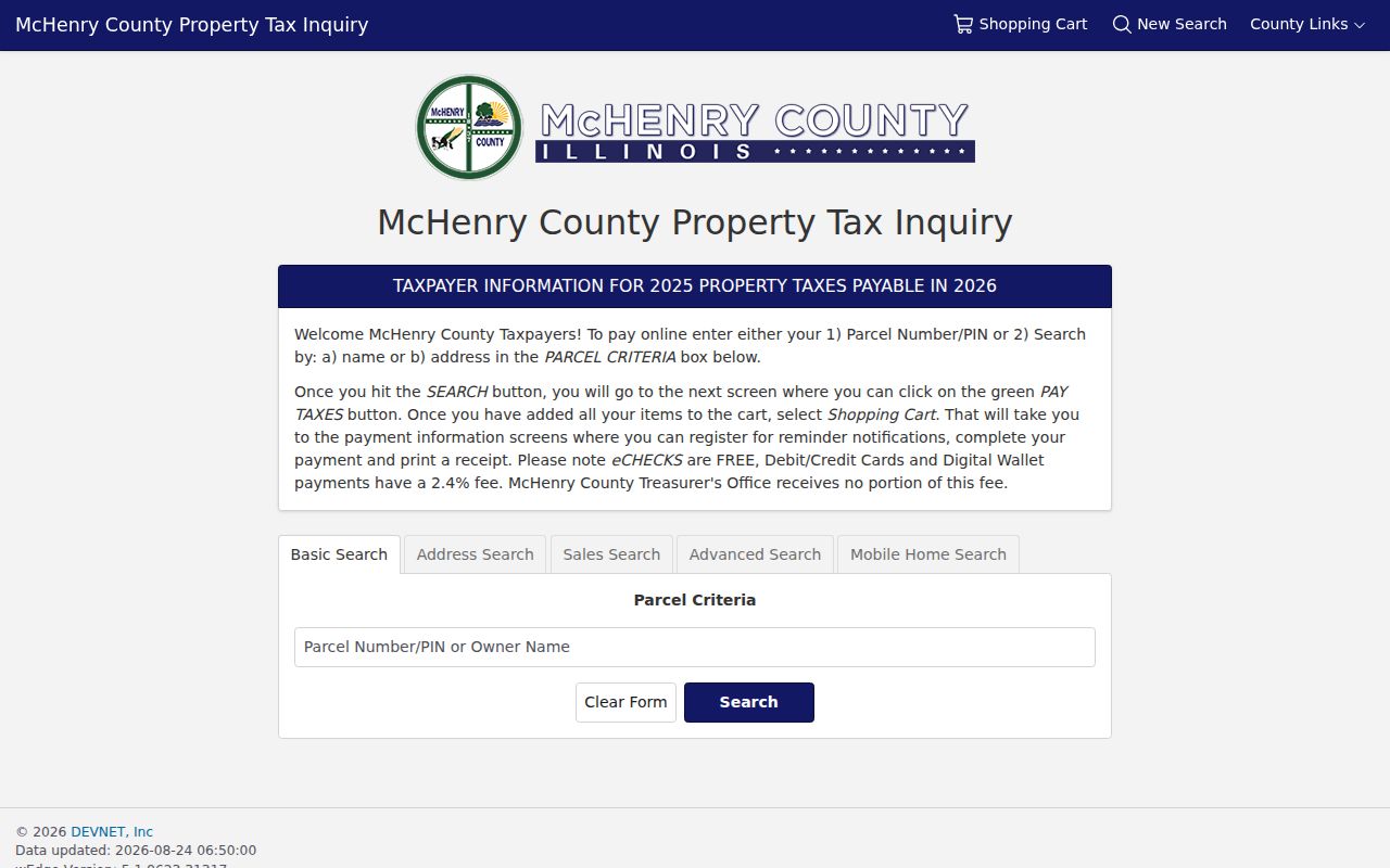
The range fields make this screen useful for checking parcels along one McHenry street, while each result still needs its own PIN and source date.
Map McHenry Parcels and Layers
Athena searches by parcel, subdivision, address, owner, or sales data and places the match on the county map. Its property information, buffer, tri-view, measurement, coordinate, and export tools help distinguish one lot from the next. PlanDev adds zoning, land use, subdivision, flood, wetland, watershed, topography, petitions, and historic imagery. These are context layers. They do not certify title or prove that a named owner occupies the site.
- Parcel
- A mapped unit of land identified by a county PIN.
- Situs address
- The physical property address, which can differ from the owner's mailing address.
- Plat
- A recorded map showing lots, blocks, streets, or a subdivision.
- Criss-cross directory
- A directory arranged by street and house number instead of surname.
PlanDev's dated imagery includes 1939 and 1967, followed by views from 2005 through 2026. Comparing those layers can show when roads, lots, or buildings changed. Pair the map with the parcel's legal description and a recorded document before drawing an ownership conclusion.
McHenry Records Listed by Address
No single McHenry street directory contains every household. Instead, separate custodians keep address-linked records for tax, mapping, recorded instruments, permits, elections, and history. The useful result is a set of dated roles, not a claim that every named person now lives there.
| Record Set | Keeper | What It Shows | Access |
|---|---|---|---|
| Property and tax roll | County Office of Assessments | PIN, site and mailing address, class, values, exemptions | Free wEdge portal |
| GIS parcel maps | McHenry County GIS | Parcel geometry, labels, sales context, zoning and imagery | Open Athena and PlanDev viewers |
| Deeds and plats | McHenry County Recorder | Parties, document type/date, parcel and legal description | Free AVA index; copies may cost |
| Voter record | Illinois SBE and County Clerk | Exact person's registration match; precinct records | Individual lookup or controlled request |
| Permit file | City Community Development | Permit type, status, applicant, inspections, close or final fields | Vendor search or City FOIA |
| Historic directory | Area libraries and MCHS | Dated names, addresses, trades, businesses, and family clues | Digital, microfilm, or appointment |
The PIN is the best link between the tax record, GIS, and recorded instruments. Permit records may accept an address or parcel number. Voter access is narrower: the state form requires a named person, birth date, ZIP, and a street choice, while a full computerized voter file is controlled by Illinois election law.
Follow McHenry Deeds by Street
The Recorder's free AVA index covers 1839 to the current search date, with a stated seven-day lag. Its basic search accepts party names, recording dates, document number and type, book, page, and reference number. Advanced modes accept address, parcel, subdivision with lot and block, or tract details. Municipality search was disabled in the inspected settings, an easy trap when a user expects a city filter.
The Recorder can locate an index entry but does not perform or guarantee a title search. Free image viewing was disabled in the inspected AVA settings. Tapestry sells individual copies, and Laredo provides broader account access. Calling 815-334-4110 with a document number is the office fallback for copies.
The official AVA search displays the county's available index modes.
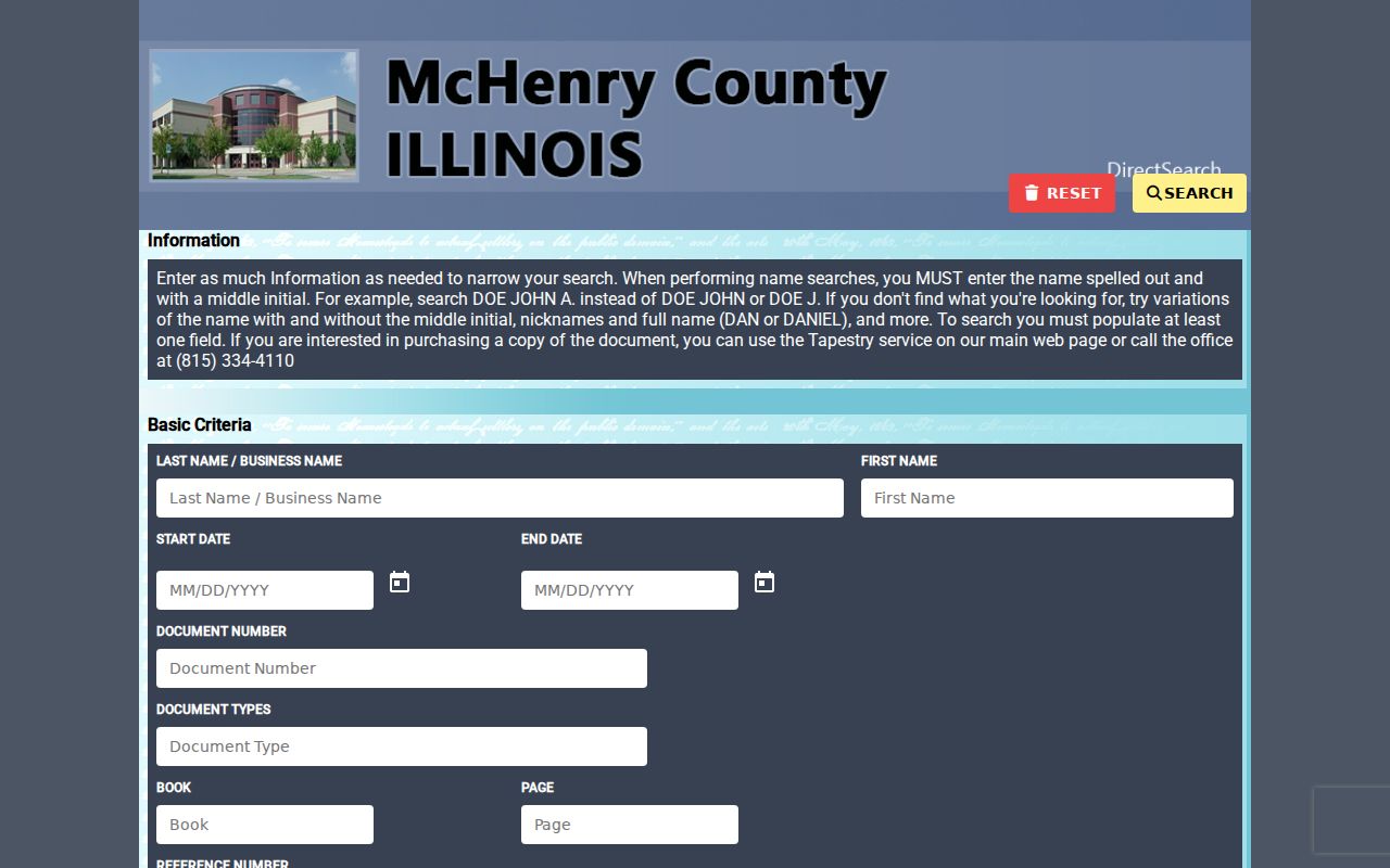
The screen supports a deed-chain search after the street address has been tied to a PIN, but a very recent filing may not yet appear.
Search tip. Save the PIN, tax year, and legal description from wEdge before searching the Recorder, especially when an owner has a common name.
Check McHenry Permits and Wards
The city, not the county, keeps McHenry municipal permits, licenses, ordinances, and council files. The building permit page says applications can be made online or at the Municipal Center. A focused request can ask for permit number, issue and close dates, property address, permit type, status, applicant or owner field, inspections, and any final certificate.
The linked permit vendor advertises searches by address, name, and parcel, but its live field set could not be verified during research. If it fails, submit a request through the City NextRequest portal or contact the City Clerk. The city map center separately links wards, zoning, developments, landmarks, TIF areas, and future land use. Always record the map date and legend.
Read Older McHenry Street Names
Historic address research needs more than a modern street spelling. City history uses Gagetown or West McHenry and Centerville or Riverside as older area names. The Fox River and rail corridor also help anchor a vague reference. Search those terms in newspapers, atlases, and local files when today's label produces no result.
Woodstock Public Library documents Haines Chicago Far North Suburban criss-cross volumes from 1977 forward and telephone books from 1948, plus vertical files arranged by street or house. Exact year-by-year shelf coverage must be checked with library staff. The historical collections themselves are treated in the McHenry city directory collections.
For older geography, MCHS and area libraries hold the 1839 survey, an 1862 landowner map, atlases from 1872, 1892, and 1908, plats, and Sanborn maps. Every match should retain its year, repository, page or sheet, and the historic place name used.
Separate McHenry ZIP and City
Official local material lists both 60050 and 60051 for McHenry postal service. A ZIP is a delivery zone, not proof of a city boundary, ward, township, tax district, parcel, or current residence. Use the USPS ZIP Code Lookup for the full delivery address, then compare city and county maps.
wEdge searches a house-number range, street, and city but has no standalone ZIP field on its inspected Address tab. Recorder AVA does include ZIP with house number, street, and city. Keep the site address, tax mailing address, and USPS-validated postal address as separate fields.
Limits of McHenry Street Records
Address records do not form a complete household roster. A parcel card usually names an owner and mailing addressee, not every occupant. A deed records parties to an instrument. A permit may name an applicant or contractor. The state voter tool confirms only the person entered with its required matching data. Driver-address information is restricted under 625 ILCS 5/2-123, and no public utility-customer directory was found in the official sources.
Mark every street-directory result with the source, record role, and date. Recent deeds may be absent during AVA's lag. Map labels can trail a recording. Historic directories can be wrong or incomplete. When an online tool fails, use the relevant office counter, phone, mail, or FOIA channel rather than filling a gap with inference.
Lawful use. McHenry address records are for lawful personal research. Never use a street directory to stalk, harass, threaten, or harm anyone.